


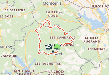

9,4 km | 11,2 km-effort

Marcher en groupe en veillant au respect de chacun et à la bonne humeur.


Aplicación GPS de excursión GRATIS
 SityTrail
IGN / Institutos geográficos
SityTrail World
El mundo es suyo
Ruta Senderismo de 12 km a descubrir en Borgoña-Franco Condado, Saona y Loira, Les Bizots. Esta ruta ha sido propuesta por PASSION RANDO.
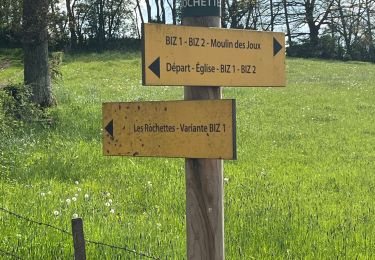
circuit balisé jaune de la CUCM réf : BI72
Senderismo

Senderismo

sport
Senderismo
Senderismo

Bici de carretera
Senderismo
Senderismo

Moto